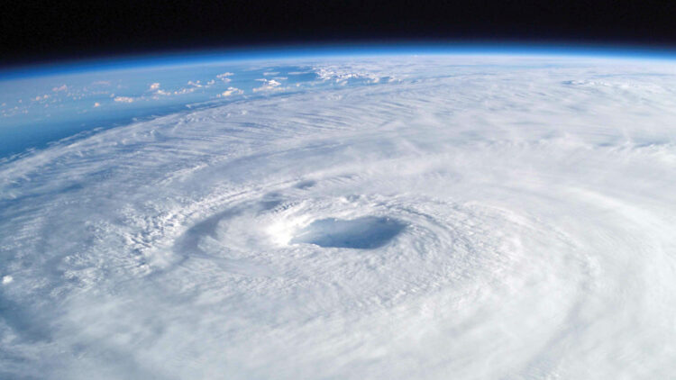
In recent years, the power and frequency of hurricanes have escalated dramatically, leading scientists to investigate the catastrophic potential of a theoretical mega-storm known as the “hypercane.” While hurricanes such as Irma and Katrina have devastated communities, a hypercane could overshadow these events, presenting unprecedented risks to coastal regions and the broader environment. As climate changes continue to alter ocean temperatures, the likelihood of hypercane formation becomes increasingly concerning.
What exactly is a hypercane?
A hypercane is a hypothetical super-hurricane that could form under extreme conditions, specifically when ocean temperature soars to between 113 to 122 degrees Fahrenheit.
Dr. Kerry Emanuel—who proposed the hypercane concept in the 1990s—explains that such storms could produce winds exceeding 500 miles per hour, far surpassing the current Saffir-Simpson scale, which caps at Category 5. The eye of a hypercane could measure 186 miles across, unleashing destruction on a continental scale.
Climate change plays a critical factor in the increasing threat of hypercanes. As ocean temperatures rise, the chances of more intense storms heightens. A recent study indicates that the probability of “grey swan” tropical cyclones could rise, with regions such as Tampa, Florida, facing storm surges of up to 36 feet. With the persisting warming trends, these probabilities could rise by a drastic margin by the end of the century.
The study’s findings paint a bleak picture where conditions could easily give rise to hypercanes, as the Gulf of Mexico serves as a breeding ground for such catastrophic events.
The consequences of a hypercane
The potential ramifications of a hypercane extend beyond immediate destruction. Experts warn that these storms could significantly damage the ozone layer, increasing exposure to harmful solar radiation. The hypercane’s towering clouds could reach heights of up to 25 miles, triggering chemical reactions in the atmosphere that deplete this important shield.
As Dr. Emanuel states, the onset of a hypercane could result in conditions “comparable to those that emit an atomic bomb,” leaving entire ecosystems in peril.
Furthermore, the rapid intensification of hurricanes has already been observed in recent years, with storms such as Hurricane Katrina changing from Category 1 to Category 5 almost overnight. This phenomenon indicates that hypercanes could form with little warning, making evacuation nearly impossible.
Other storms, such as Hurricanes Allen and Camille, illustrate that such rapid developments are not just hypothetical; they’re alarming realities that could recur with greater frequency.
The future of potential hurricane evolution
As Earth continues to warm, the emergence of hypercanes might not be as implausible as it seems. Some scientists predict a future with Category 6 or even Category 7 storms, with wind speeds topping 217 miles per hour.
These storms could double in frequency in vulnerable regions such as the Gulf of Mexico, heightening the need for communities to prepare for increasingly severe hurricane seasons.
With a hyperactive hurricane season on the horizon, the risks for coastal cities grow. Florida, for example, faces a great chance of major hurricanes, yet policies denying climate change impede necessary preparedness. Residents already grappling with rising insurance costs and past hurricane devastation must confront the harsh reality of a changing climate that could bring hypercanes into fruition.
The hypercane represents a looming threat that could alter our understanding of natural disasters. As climate change continues to warm our oceans and disrupt weather patterns, the possibility of these catastrophic storms rises. It’s imperative that we recognize and address the risks posed by hypercanes to safeguard our communities and ecosystems from possible annihilation. In the face of such dire prospects, proactive measures and comprehensive planning are important to mitigate the impacts of these super-storms.

